Windhover
Windhover
Windhover is a versatile platform that can be used with various payloads, including camera Digital Eye2. With its flexibility and configurability, Windhover can
be customized for specific tasks, ensuring efficiency and accuracy in data collection and processing
UAV CAN-bus integration across all hardware components ensures fast data exchange and efficient diagnostics.
ADS-B receiver available. Data can be transferred through Internet connection.
Supports real-time data processing and archiving. All identified objects are tagged with exact geographic coordinates and time data
Backup navigation system ensures safe operation if the engine fails
UAV CAN-bus for the entire hardware to increase the speed of data exchange and diagnostics
Fast integration with existing control and monitoring systems
Compatible with any device supporting TCP/IP
Supports data exchange via satellite communication
MTOW
11,5 kg
FLIGHT DURATION
45-60 min
SPEED
15 m/s
range
8 km
FULL CONTROL AT A WIND SPEED
15 m/s
Weather conditions
-25 +59 С, humidity 95%
Digital Eye 2 is a unique payload designed for UAVs to enable long-range object detection and surveillance in extreme weather conditions. It integrates two cameras — a 4K color camera and a thermal imaging camera — to ensure comprehensive monitoring capabilities both day and night.
4K Color Camera
Tracks objects at distances of 4 to 16 kilometers using a combination of optical and digital zoom.
Features anti-fog technology and an infrared filter for enhanced performance in low-light conditions.
Thermal Camera
Nighttime imaging is provided by the thermal camera, which detects objects at distances of 2.5–3 kilometers in complete darkness. It features multiple color palettes for various conditions and supports both day and night operation
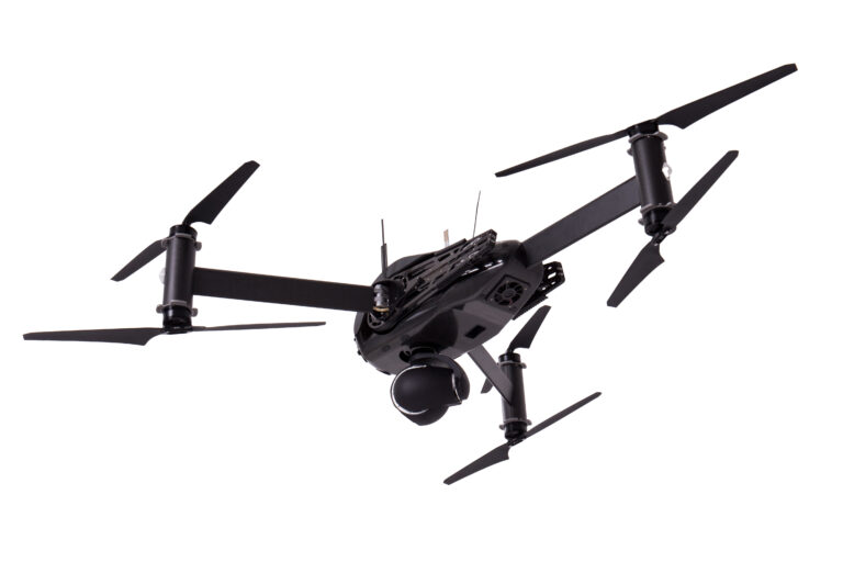
Supports live target detection, recognition, identification, and acquisition.
Transmits video in multiple formats including 480p, 720p, and 1080p, depending on mission requirements.
Ideal for territory surveillance, object tracking, and environmental monitoring.
Printed version of information


